
Rain, wind and colder temperatures are expected late next week. Significant local snow remains unconfirmed.
Editorial alert, not an official National Weather Service warning. Forecast checked November 7, 2026.
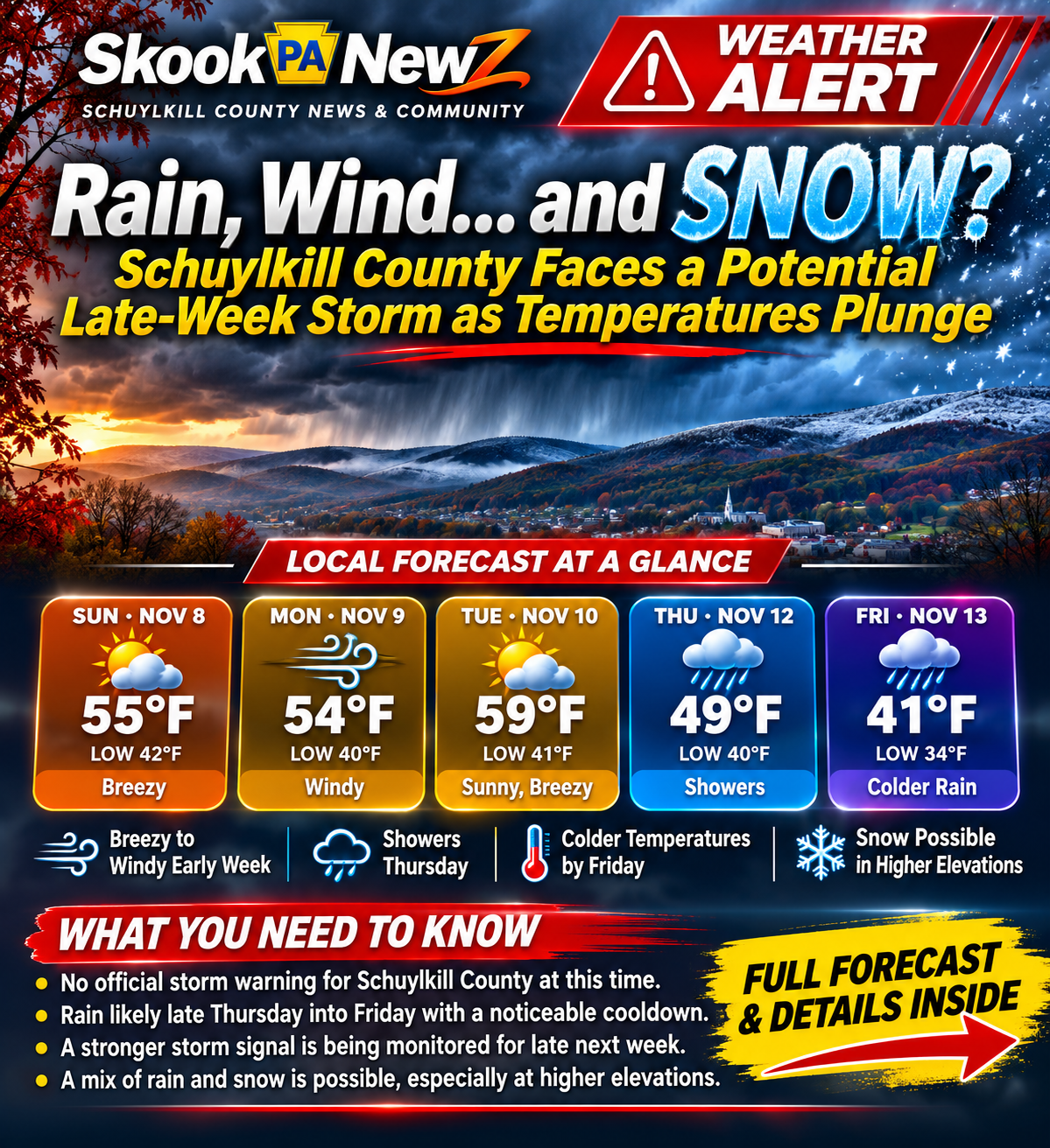
SCHUYLKILL COUNTY, Pa. — An early taste of winter could be waiting at the end of a changing November weather pattern. After one of central Pennsylvania’s warmest starts to November in recent memory, temperatures are set to turn cooler. Breezy and windy days come first, with rain expected later next week — and forecasters are watching whether a stronger coastal storm may develop.
The big question: could we see snow? The National Weather Service’s November 7 forecast discussion says a potential coastal storm could eventually bring precipitation that includes accumulating snow, especially at higher elevations. Forecasters stress that the signal is preliminary and confidence is low. The current New Boston and Pottsville-area forecast favors showers Thursday, November 12, and colder rain Friday, November 13, not a confirmed accumulating snowfall.
Forecast at a glance
New Boston-area temperatures (high/low): Sunday, Nov. 8: 55°/42°, breezy; Monday: 54°/40°, windy; Tuesday: 59°/41°, sunny and breezy; Wednesday: 57°/38°, clouds and sun; Thursday: 49°/40°, showers; Friday: 41°/34°, colder rain. The large weather infographic above shows the main trends. Forecast checked November 7; actual conditions may change.
Wind arrives before the wetter weather
A compact upper-level disturbance and cooler air are bringing scattered showers and a noticeable chill across central Pennsylvania. In its Saturday discussion, the National Weather Service State College office anticipated peak gusts generally around 25–35 mph across the region, with some gusts potentially around 40 mph Monday. That does not mean every town in Schuylkill County will experience 40-mph winds; local conditions and exposure matter.
Residents heading out on mountain roads or parking near older trees should secure loose outdoor objects and check conditions before driving.
Thursday and Friday: turning wet and raw
Thursday’s forecast calls for a high near 49°F with a couple of showers. Friday looks colder, with periods of rain and a high only around 41°F, dropping into the mid-30s overnight. The combination could make outdoor work, school sports and evening travel uncomfortable even without snow.
What would have to happen for snow?
For an accumulating snowfall, a storm would need to develop in the right place and bring moisture at the same time as sufficiently cold air. The latest National Weather Service discussion flagged that combination as a possibility late in the week — particularly for higher terrain — but has not pinned down a local snow total or confirmed a storm track.
The distance between a cold rain and early-season wet snow can be small in the Appalachian ridges. Rather than treating a model image circulating on social media as a certainty, watch for updated official forecasts over the coming days.
Are any alerts in effect?
As of the November 7 check, no National Weather Service watches, warnings or advisories were posted for Schuylkill County in the checked outlook. This article’s red ‘Weather Alert’ banner is a SkookPA editorial label for a developing forecast, not a government-issued alert.
What Schuylkill County residents should do now
- Bring in lightweight decorations, trash cans and other objects that could blow around.
- Check windshield wipers, tires, headlights and your vehicle’s heater before the colder rain arrives.
- Watch for forecast changes if traveling across Broad Mountain, Route 61, Route 309 or rural higher-elevation roads.
- Check the latest NWS updates before sharing snowfall predictions or road-closure rumors.
Check official updates: National Weather Service — Schuylkill County forecast and alerts · NWS State College forecast discussion · 511PA live road conditions.
Image note: Original SkookPA News editorial weather illustration. Graphic portrays a possible weather pattern, not an observed storm. Forecast details are time-sensitive.



0 Comments